WRC-funded study evaluating use of space-based sensors to monitor wetlands


The Water Research Commission (WRC) is funding a three-year project, led by the Council for Scientific and Industrial Research (CSIR), to assess whether remote sensing from orbiting satellites could provide South Africa with an opportunity to monitor its wetlands.
Currently, remote sensing from orbiting satellites provides “unprecedented opportunities” for monitoring changes in terrestrial and marine ecosystems and the project aims to assess whether it could do the same for South Africa’s wetlands, many of which are hidden beneath forest canopies or other vegetation or exist only as temporary pans after rainfall.
The project is focused on the Maputaland Coastal Plain, which makes up more than 8 000 km2 of northern KwaZulu-Natal, along the eastern coastline.
According to the WRC, the Maputaland Coastal Plain, where wetlands are estimated to account for about a quarter of the total area, is a biodiversity hot spot with a diverse range of wetland types, including swamp forests, mangroves, floodplain forests, grass and sedge wetlands and the country’s largest natural open-water wetlands.
These include Lake St Lucia, the Kosi Bay system and the freshwater Lake Sibaya, all of which are designated Ramsar Wetlands of International Importance and protected within the iSimangaliso Wetland Park.
“Remote sensing could be a valuable tool for monitoring the Maputaland Coastal Plain’s wetlands, which are often difficult and dangerous to access, owing to muddy environments and potential encounters with animals such as hippo, crocodile, buffalo and elephant,” says project leader Dr Heidi van Deventer.
“Remote sensing will hopefully allow us to detect what type of changes are taking place in the landscape, and quantify the rate and extent of those changes. It is already being used in South Africa for monitoring large waterbodies, mostly dams. Our natural wetlands are predominantly vegetated rather than open-water systems.”
The most recent National Biodiversity Assessment, undertaken in 2018, found wetlands, which are also important regulators of the hydrological system, acting as sponges to filter water and slow down floodwaters, to be the country’s most threatened ecosystems.
On the Maputaland Coastal Plain, wetlands are negatively impacted by slash-and-burn agriculture; excessive water abstraction, particularly during droughts; alien invasive vegetation; and timber plantations.
Plantation trees cause a lowering of groundwater levels because their root systems are deeper and their evapotranspiration rates higher than those of indigenous trees, according to the WRC.
“This, combined with natural dry cycles in general, but especially the severe drought in 2015/16, has contributed to an increase in the number and extent of desiccation of peatland, and, in some instances, these peatlands burn after surface fires in the region.”
There are also concerns about the additional pressures that climate change, such as rising surface temperatures and extreme droughts, will exert on the region’s wetlands.
The region is home to local communities that depend on the wetlands for fish and other foods, water supply and materials used in construction and crafts, such as thatching, mats and baskets.
“Many of the wetlands of the Maputaland Coastal Plain are under severe stress, yet they are so important to the marginalised sectors of our communities that rely on them for food and other ecosystem services,” says WRC research manager, who is overseeing the project, Bonani Madikizela.
The project team will be engaging with these communities to understand their perceptions, beliefs and attitudes about the wetlands and their conservation, as well as with other stakeholders in the area.
Van Deventer explains that the study, which will see the team conduct weekly time-series analyses for accurately quantifying wetland change in future, will use the more recent Sentinel-1 and -2 satellites to examine a 10 × 10 m pixel.
The Sentinel satellites form part of a series of satellite missions developed by the European Union’s earth observation programme, the European Space Agency for Copernicus.
“The two Sentinel-1 twin satellites, A and B, each have a Synthetic Aperture Radar instrument that acquires data in any weather conditions and during the day and night. The radar data is useful for detecting water and moisture, even when it is beneath some of the grass and sedge vegetation canopy,” Van Deventer explains.
The two Sentinel-2 satellites, meanwhile, have a MultiSpectral Instrument that provides optical data sampled from 13 bands across the electromagnetic spectrum, from visible light to shortwave infrared.
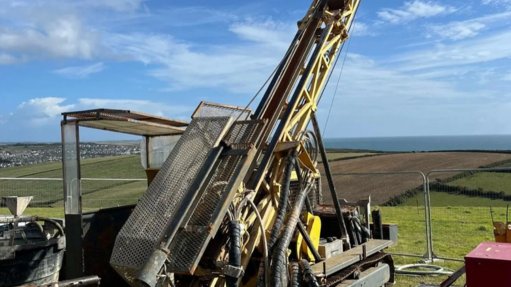
The research project also involves fieldwork to validate the satellite data through ground-truthing.
“Ultimately, we hope to use remote sensing for automated monitoring of wetland changes on a regional scale. The points collected during a field campaign are then used in software programmes with machine learning algorithms to assess the accuracy of our classification. A map is then produced with each of the classes, showing the extent across the Maputaland Coastal Plain.”
The team can then quantify the extent and measure changes against the original extent mapped, which will enable areas in need of rehabilitation to be more easily identified and prioritised.
“If successful, the intention is to incorporate this capability into the National Wetland Monitoring Programme.”
The project, or aspects of the research, is cofunded through two CSIR Parliamentary grant projects.
Article Enquiry
Email Article
Save Article
Feedback
To advertise email advertising@creamermedia.co.za or click here
Research Reports
Projects

Latest Multimedia
Showroom
Goodwin Submersible Pumps Africa is sole distributors for Goodwin electrically driven, submersible, abrasion resistance slurry pumps.
VISIT SHOWROOM
Stewarts & Lloyds is a leading steel, tube, and engineering product supplier in South Africa.
VISIT SHOWROOM
Announcements
What's On
Subscribe to improve your user experience...
Option 1 (equivalent of R125 a month):
Receive a weekly copy of Creamer Media's Engineering News & Mining Weekly magazine
(print copy for those in South Africa and e-magazine for those outside of South Africa)
Receive daily email newsletters
Access to full search results
Access archive of magazine back copies
Access to Projects in Progress
Access to ONE Research Report of your choice in PDF format
Option 2 (equivalent of R375 a month):
All benefits from Option 1
PLUS
Access to Creamer Media's Research Channel Africa for ALL Research Reports, in PDF format, on various industrial and mining sectors
including Electricity; Water; Energy Transition; Hydrogen; Roads, Rail and Ports; Coal; Gold; Platinum; Battery Metals; etc.
Already a subscriber?
Forgotten your password?
Receive weekly copy of Creamer Media's Engineering News & Mining Weekly magazine (print copy for those in South Africa and e-magazine for those outside of South Africa)
➕
Recieve daily email newsletters
➕
Access to full search results
➕
Access archive of magazine back copies
➕
Access to Projects in Progress
➕
Access to ONE Research Report of your choice in PDF format
RESEARCH CHANNEL AFRICA
R4500 (equivalent of R375 a month)
SUBSCRIBEAll benefits from Option 1
➕
Access to Creamer Media's Research Channel Africa for ALL Research Reports on various industrial and mining sectors, in PDF format, including on:
Electricity
➕
Water
➕
Energy Transition
➕
Hydrogen
➕
Roads, Rail and Ports
➕
Coal
➕
Gold
➕
Platinum
➕
Battery Metals
➕
etc.
Receive all benefits from Option 1 or Option 2 delivered to numerous people at your company
➕
Multiple User names and Passwords for simultaneous log-ins
➕
Intranet integration access to all in your organisation