Southern Mapping aerial surveys and geospatial solutions


Established in 2006, Southern Mapping Company provides aerial light detection and ranging, or LiDAR, surveys and geospatial solutions to clients in Africa. The company created a watershed moment in the history of surveying in Africa when it became the first independently owned LiDAR company on the continent.
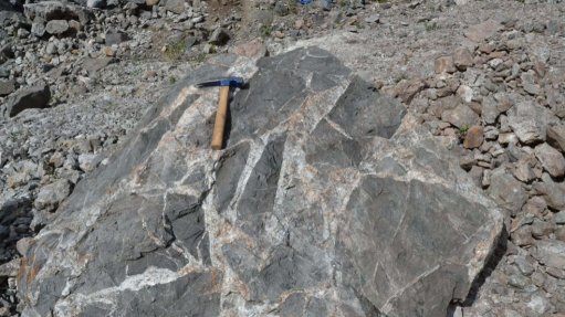
To date, Southern Mapping Company has surveyed a thousand projects in over 40 countries, offering a wide variety of services and bespoke solutions to the mining industry.
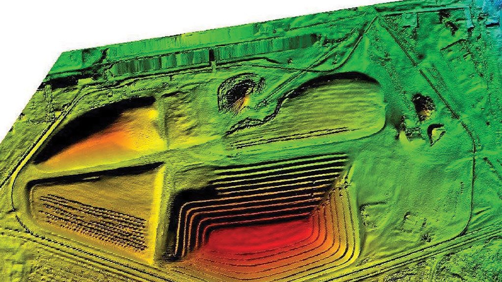
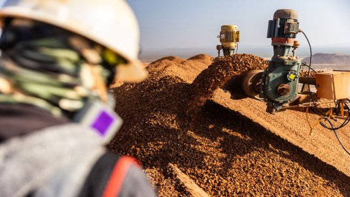
Southern Mapping surveys mine pits and stockpiles to provide a regular and rapid turnaround of accurate information about stockpile volumes. The size of a mine’s stockpile represents potential income and measuring these waste dumps provides an understanding of a mine’s profitability.
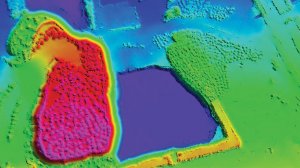
In addition, the company provides solutions for environmental and mine rehabilitation monitoring, through the use of high resolution multispectral satellites and airborne, mounted hyperspectral and LiDAR camera systems.Using imagery from the short wave, infrared wavelengths of the electromagnetic spectrum, it is possible to map vegetation and the health status of plants. By mapping the relative chlorophyll content in rehabilitated sites, stressed zones can be identified and the success of rehabilitation projects can be assessed.
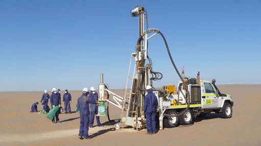
Southern Mapping also provides a phased, remote-sensing approach to mapping for mineral exploration. Multispectral satellite imagery and digital elevation model, or DEM, data is used in early exploration phases to develop broad spectrally-based geological, mineralogical and structural maps, as well as potential target zones.
Opencast pits, shafts, roads, plants, dams, dump sites and infrastructure associated with mines require careful planning and detailed design. Southern Mapping’s high-accuracy, airborne LiDAR surveys provide the elevation models, above ground feature information and high resolution orthoimagery necessary to achieve this.
Article Enquiry
Email Article
Save Article
Feedback
To advertise email advertising@creamermedia.co.za or click here
Research Reports
Projects

Latest Multimedia
Latest News

Showroom
Occupational health services, mobile clinics, wellness campaigns, aviation.
VISIT SHOWROOM
Established on 1 March, 2000, by Barries Barnard, Advanced Fire Suppression Technologies (AFST) and the Advanced Group stands as Sub-Saharan...
VISIT SHOWROOM
Press Office
Announcements
What's On
Subscribe to improve your user experience...
Option 1 (equivalent of R125 a month):
Receive a weekly copy of Creamer Media's Engineering News & Mining Weekly magazine
(print copy for those in South Africa and e-magazine for those outside of South Africa)
Receive daily email newsletters
Access to full search results
Access archive of magazine back copies
Access to Projects in Progress
Access to ONE Research Report of your choice in PDF format
Option 2 (equivalent of R375 a month):
All benefits from Option 1
PLUS
Access to Creamer Media's Research Channel Africa for ALL Research Reports, in PDF format, on various industrial and mining sectors
including Electricity; Water; Energy Transition; Hydrogen; Roads, Rail and Ports; Coal; Gold; Platinum; Battery Metals; etc.
Already a subscriber?
Forgotten your password?
Receive weekly copy of Creamer Media's Engineering News & Mining Weekly magazine (print copy for those in South Africa and e-magazine for those outside of South Africa)
➕
Recieve daily email newsletters
➕
Access to full search results
➕
Access archive of magazine back copies
➕
Access to Projects in Progress
➕
Access to ONE Research Report of your choice in PDF format
RESEARCH CHANNEL AFRICA
R4500 (equivalent of R375 a month)
SUBSCRIBEAll benefits from Option 1
➕
Access to Creamer Media's Research Channel Africa for ALL Research Reports on various industrial and mining sectors, in PDF format, including on:
Electricity
➕
Water
➕
Energy Transition
➕
Hydrogen
➕
Roads, Rail and Ports
➕
Coal
➕
Gold
➕
Platinum
➕
Battery Metals
➕
etc.
Receive all benefits from Option 1 or Option 2 delivered to numerous people at your company
➕
Multiple User names and Passwords for simultaneous log-ins
➕
Intranet integration access to all in your organisation