Drone Technology: Working with Surveyors, Not Against Them


This article has been supplied.
A common misconception among mine surveyors is that drone technology will take over their jobs and leave them out of work. However, this is not the case. Drone technology can be a powerful operational asset in the surveyor’s arsenal and here are four key benefits that surveyors can incur by implementing drone technology in their operation:
1. Data Accuracy
Using drone data, surveyors can achieve greater accuracies over larger areas of a project in a far timelier manner compared to manual surveying methods.
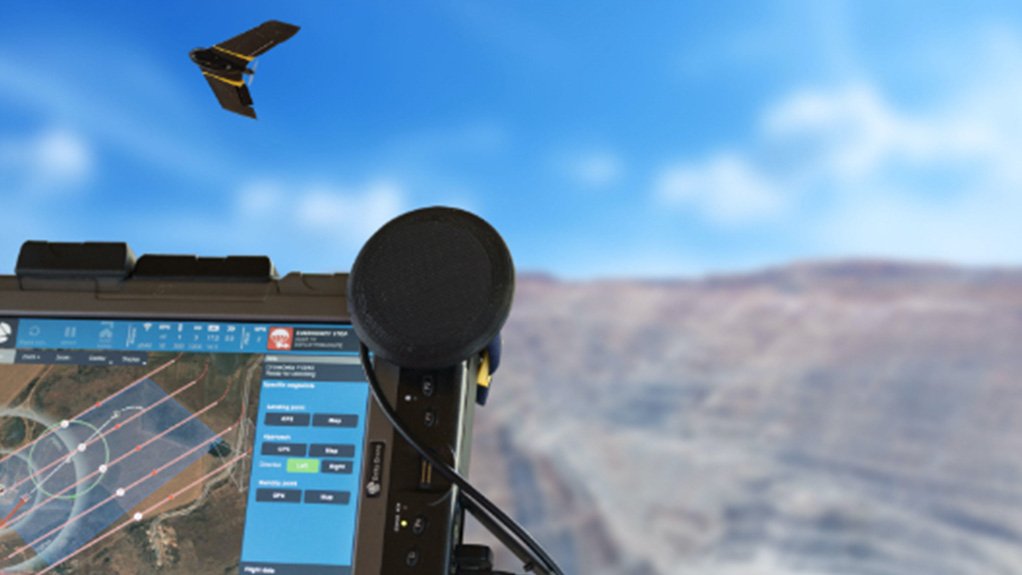
For example, with a total station, surveyors are only able to measure individual points but with the imagery collected from one drone flight, surveyors can collect thousands of geo-referenced data points. These data points can then be converted into a variety of formats including orthomosaics, point clouds, contour lines, digital terrain models (DTM), digital surface models (DSM) and much more.
Drone data also allows surveyors to precisely monitoring the ever-changing features of mines and receive accurate daily updates on stockpiles, stacks, open pits, tailings dams and much more - ensuring better oversight.
Once drone data has been collected it serves as a permanent record of that area at that point in time, helping reduce subjective data interpretation. This enables surveyors to make accurate measurements and enhance their reporting with datasets that are of the highest standards of accuracy and quality, affording surveyors peace of mine.
2. Reduced Costs
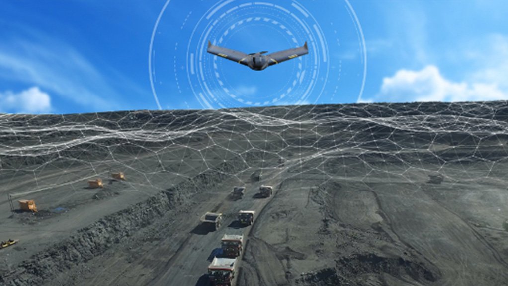
Drones help surveyors significantly reduce costs by enabling predictive analysis. This is achieved by overlaying several datasets collected from multiple flights to create a trend analysis over time, helping surveyors make educated forecasts and mitigate against potential risks. This in turn allows surveyors to decrease the rate of downstream issues and save on unexpected failure costs.
Moreover, drones allow surveyors to make their data go further as it can be used for an array of mining activities, reducing the costs associated with multiple data collections.
For example, Rocketmine – a leader in drone data acquisition, uses drones to capture detailed photogrammetric data that empowers surveyors with the information they need to manage stockpiles better, monitor quarries more effectively, improve operational planning, conduct pre and post blast monitoring, perform high-wall mapping and detect tailings dam leaks.
3. Time Saving
An additional constraint surveyors face is that traditional methods are laborious and time-consuming. Drones help to remove the menial work associated with certain surveying activities, enabling surveyors to focus their time and attention on data interpretation - which is truly the specialist part of surveying.
4. New Skills
Lastly, drone data enables surveyors to upskill. Being able to accurately interpret drone data empowers surveyors with a new tool and skillset which makes surveyors more valuable to their department and their company.
The Final Word
Drones help surveyors achieve improved data accuracies over larger areas in shorter timeframes, reduce costs, and enable surveyors to upskill when it comes data interpretation. Ultimately, the use of drones works in partnership with surveyors not against them, providing a comprehensive dataset which can be confidently rely on to conduct precise and error free volumetric calculations and reporting. Therefore, don’t waste a minute worrying about whether drones will take your job; take the chance to enhance your career and productivity today.
Article Enquiry
Email Article
Save Article
Feedback
To advertise email advertising@creamermedia.co.za or click here
Research Reports

Projects

Latest Multimedia

Latest News
Showroom
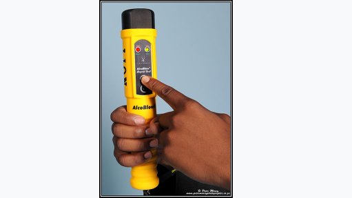
Developed to exceed the latest EN 15964 standards for police breathalysers proving that it will remain accurate and reliable for many years to come.
VISIT SHOWROOM
Rentech provides renewable energy products and services to the local and selected African markets. Supplying inverters, lithium and lead-acid...
VISIT SHOWROOM

Announcements
What's On
Subscribe to improve your user experience...
Option 1 (equivalent of R125 a month):
Receive a weekly copy of Creamer Media's Engineering News & Mining Weekly magazine
(print copy for those in South Africa and e-magazine for those outside of South Africa)
Receive daily email newsletters
Access to full search results
Access archive of magazine back copies
Access to Projects in Progress
Access to ONE Research Report of your choice in PDF format
Option 2 (equivalent of R375 a month):
All benefits from Option 1
PLUS
Access to Creamer Media's Research Channel Africa for ALL Research Reports, in PDF format, on various industrial and mining sectors
including Electricity; Water; Energy Transition; Hydrogen; Roads, Rail and Ports; Coal; Gold; Platinum; Battery Metals; etc.
Already a subscriber?
Forgotten your password?
Receive weekly copy of Creamer Media's Engineering News & Mining Weekly magazine (print copy for those in South Africa and e-magazine for those outside of South Africa)
➕
Recieve daily email newsletters
➕
Access to full search results
➕
Access archive of magazine back copies
➕
Access to Projects in Progress
➕
Access to ONE Research Report of your choice in PDF format
RESEARCH CHANNEL AFRICA
R4500 (equivalent of R375 a month)
SUBSCRIBEAll benefits from Option 1
➕
Access to Creamer Media's Research Channel Africa for ALL Research Reports on various industrial and mining sectors, in PDF format, including on:
Electricity
➕
Water
➕
Energy Transition
➕
Hydrogen
➕
Roads, Rail and Ports
➕
Coal
➕
Gold
➕
Platinum
➕
Battery Metals
➕
etc.
Receive all benefits from Option 1 or Option 2 delivered to numerous people at your company
➕
Multiple User names and Passwords for simultaneous log-ins
➕
Intranet integration access to all in your organisation