Course paves way for growth opportunities in GIS platforms


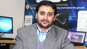
M AHSAN MAHBOOB GIS is an integral part of DigiMine's ongoing and future research and development plans
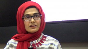
DR IQRA ATIF GIS has the potential to enhance creative collaboration and innovation significantly


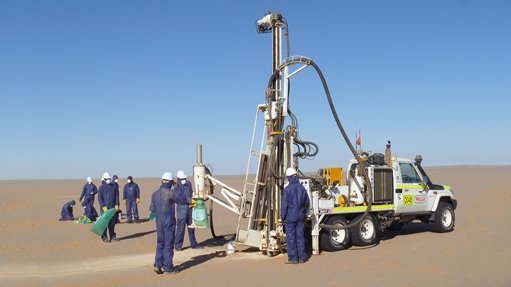
The growing interest in Geographical Information System (GIS) platforms as the preferred platform for visualising and analysing mining data in multiple dimensions, along with a shortage of qualified specialists in such systems, prompted the University of the Witwatersrand’s (Wit’s) Wits Mining Institute (WMI) to host its first online GIS short course in August.
The NQF level 7 GIS for Twenty-First Century Mining course required students to complete class assignments, in addition to the course’s final project.
The computerised information system, developed specifically for geospatial data management, combines complex statistical analysis with mapping and is “extraordinarily useful for revealing patterns and correlations within a geographical area”, explains Wits School of Geography, Archaeology and Environmental Studies senior lecturer Dr Iqra Atif.
She elaborates that, when effectively managed, GIS has the potential to enhance creative collaboration and innovation significantly.
It is also one of the most popular and in-demand skills for understanding and solving issues of the twenty-first century, including Covid-19 and climate change, geo-hazards and the management of natural resources, environmental, social and governance as well as sustainable development, Atif continues.
Therefore, the School of Geography, Archaeology and Environmental Studies offers the BSc Geospatial Sciences degree at undergraduate level, as well as the GIS and Remote Sensing Honours and MSc degrees at postgraduate level.
These programmes, along with WMI's short course, have the potential to create a skilled workforce for the future mining sector, she asserts.
Aligned to how mining companies can use GIS, the short course provides hands-on training in advanced GIS software to address complex challenges, and ensure reliability and sustainability of the mining industry in the Fourth Industrial Revolution (4IR).
The aim of the course is to enable the participants to visualise mining data and turn it into information using geo-analytics. Human interaction and innovation can then translate such information into knowledge, insight and understanding, which can assist in better decision-making, explains Atif.
The course included concepts, from fundamental to advanced geospatial analytics, with seven theoretical lectures followed by seven practical training exercises.
WIM’s course material is developed around the applications and lessons emerging from research done at the Sibanye-Stillwater digital mining laboratory (DigiMine) in Johannesburg.
DigiMine head M Ahsan Mahboob explains that GIS is an integral part of DigiMine's ongoing and future research and development plans, owing to its handling of complex and large datasets in near real time and its providing customised solutions for specific mining industry challenges.
Owing to high demand from industry professionals and students, WMI intends to offer this course through its Skills Accelerator Centre again in 2023.
GIS for the Future of Mining
In recent years, applications of GIS-based effective monitoring, management and modelling of natural resources have gained increasing acceptance under the 4IR.
Advanced spatial analytics using the system can also help the mining industry to uncover patterns and trends that are difficult to see in charts, tables or spreadsheets, explains Atif.
In her work done at the tailings dam failure at Jagersfontein, Atif used geospatial technologies to evaluate the real change around the dam and then created a GIS-based numerical model that incorporates machine learning and multiphysics algorithms to simulate dam failure.
She explains that the spatial change assessment indicated that the tailing dam’s area was increased from 0.24 km2 in 2010 to 0.83 km2 in 2021, a total increase of 245% in 11 years.
Atif also conducted a post-disaster comprehensive damage assessment for possible infrastructure by digitising the data of year 2021.
She explains that GIS can support the entire mining value chain through its many features.
Therefore, the full potential of GIS needs to be understood and brought into mining operations by qualified specialists to ensure local mines are able to evolve, she concludes.
Article Enquiry
Email Article
Save Article
Feedback
To advertise email advertising@creamermedia.co.za or click here
Research Reports
Projects
Latest Multimedia
Latest News
Showroom
As a reticulator, Egoli Gas provides natural gas to homes and businesses via underground pipes.
VISIT SHOWROOM
Complete range of security sealing solutions including security seals bags and labels.
VISIT SHOWROOM
Announcements
What's On
Subscribe to improve your user experience...
Option 1 (equivalent of R125 a month):
Receive a weekly copy of Creamer Media's Engineering News & Mining Weekly magazine
(print copy for those in South Africa and e-magazine for those outside of South Africa)
Receive daily email newsletters
Access to full search results
Access archive of magazine back copies
Access to Projects in Progress
Access to ONE Research Report of your choice in PDF format
Option 2 (equivalent of R375 a month):
All benefits from Option 1
PLUS
Access to Creamer Media's Research Channel Africa for ALL Research Reports, in PDF format, on various industrial and mining sectors
including Electricity; Water; Energy Transition; Hydrogen; Roads, Rail and Ports; Coal; Gold; Platinum; Battery Metals; etc.
Already a subscriber?
Forgotten your password?
Receive weekly copy of Creamer Media's Engineering News & Mining Weekly magazine (print copy for those in South Africa and e-magazine for those outside of South Africa)
➕
Recieve daily email newsletters
➕
Access to full search results
➕
Access archive of magazine back copies
➕
Access to Projects in Progress
➕
Access to ONE Research Report of your choice in PDF format
RESEARCH CHANNEL AFRICA
R4500 (equivalent of R375 a month)
SUBSCRIBEAll benefits from Option 1
➕
Access to Creamer Media's Research Channel Africa for ALL Research Reports on various industrial and mining sectors, in PDF format, including on:
Electricity
➕
Water
➕
Energy Transition
➕
Hydrogen
➕
Roads, Rail and Ports
➕
Coal
➕
Gold
➕
Platinum
➕
Battery Metals
➕
etc.
Receive all benefits from Option 1 or Option 2 delivered to numerous people at your company
➕
Multiple User names and Passwords for simultaneous log-ins
➕
Intranet integration access to all in your organisation