Geographical Information System (GIS) platforms are becoming the preferred platform for visualising and analysing mining data in multiple dimensions, making the Wits Mining Institute’s (WMI) upcoming GIS course a must-attend for mining professionals.
Due to the high demand of the course at international level, this year the course – GIS for 21st Century Mining – will be held online, from 17 to 19 August 2022.
The course material has been developed around applications and lessons emerging from research done at the Sibanye-Stillwater digital mining laboratory (DigiMine), the WMI’s flagship project. The course is aimed at people working in the mining sector, government and academia, and will cover applications throughout the mining value chain.
“GIS provides spatial solutions and services that are based on evidence as well as scenarios in order to facilitate intelligent decision making for mining industry” said M Ahsan Mahboob, the head of the DigiMine at WMI. “The course will provide hands-on training in advanced GIS software to address complex challenges and ensure reliability and sustainability of the mining industry in the 4th Industrial Revolution.”
Mahboob emphasised that GIS proficiency in aspects of mineral resource management will assist in improving efficiency, health and safety, profitability and sustainable utilisation of assets.
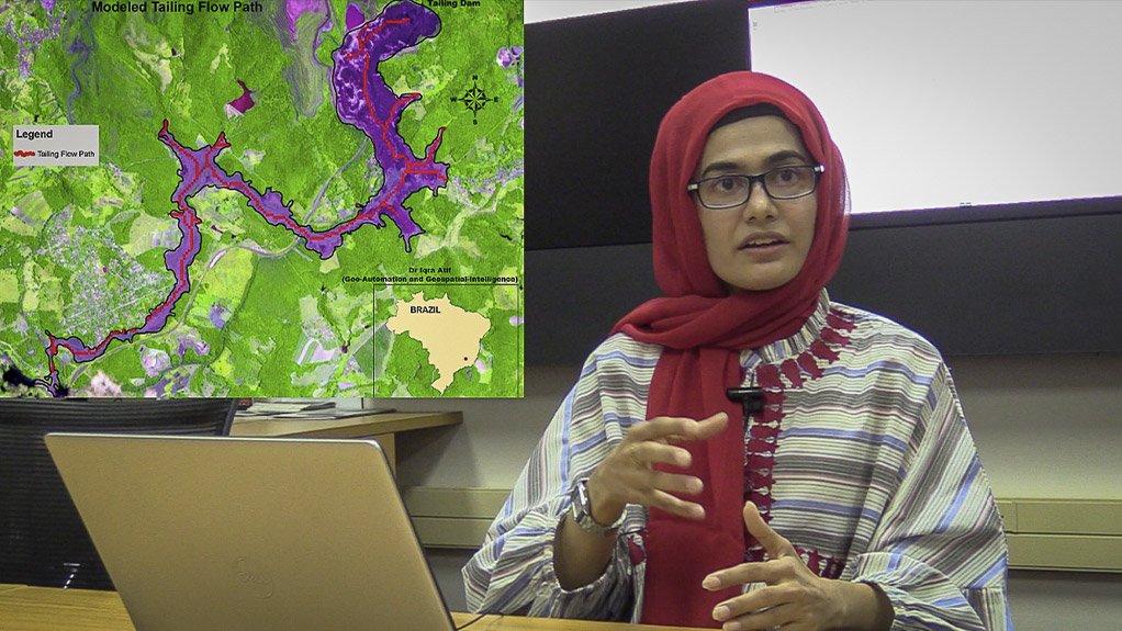
Dr Iqra Atif, Senior Lecturer of the School of Geography, Archaeology and Environmental Sciences at Wits University, highlighted that, “GIS is a desirable skill of 21st century, hence, a number of students possessing this skill have been hired while still in the program”.
“The advanced spatial analytics through GIS can help the mining industry to uncover patterns and trends that are difficult to see in charts, tables, or spreadsheets,” said Atif. “This course will enable the participants to visualise mining data and turn it into information using geo-analytics. Human interaction and innovation can translate such information into knowledge, insight, and understanding which can further be used to assist in better decision making.”
The course’s content includes: an introduction to GIS; understanding GIS software; spatial data models; collection, creation and editing of geospatial data; design and management of geo-databases; and geospatial analysis for information extraction. It will also cover geo-visualisation, cartographical skills and map design and layout for accurate data presentation. Practical case studies from DigiMine and its partner organisations will also be presented.
The cost for corporates is R7,500 (including VAT) and for students is R3,000 (including VAT).