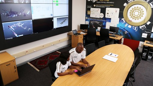
Wits DigiMine Control room with Wits students Nonhle Phiri and Peter Kolapo
The global demand for the upcoming Wits Mining Institute (WMI) course on Geographical Information Systems (GIS) for 21st Century Mining has led to the event being held online.
“This creates an exciting opportunity for participants all over the world to benefit from the growing value of GIS platforms in visualising mining data in multiple dimensions,” said M Ahsan Mahboob, the head of the Sibanye-Stillwater digital mining laboratory (DigiMine), WMI’s flagship project.
Taking place from 28-30 June 2021, the course will cover applications and lessons from the research being conducted at the DigiMine. It will also include hands-on training in advanced GIS software to address complex challenges in mining and to ensure reliability and sustainability of mining in the 4th Industrial Revolution.
The course is aimed at people working in the mining sector, government and academia, and will cover applications throughout the mining value chain.
Mahboob highlighted that GIS provides evidence-based and scenario-based spatial solutions and services for intelligent decision making.
“GIS proficiency in aspects of mineral resource management will assist participants to improve efficiency, health and safety, profitability and sustainable utilisation of assets,” he said.
According to Professor Fred Cawood, Director of the Wits Mining Institute, GIS skills empower mining professionals to organise and visualise a wide spectrum of unrelated data – in turn supporting the responsible development of scarce, non-renewable resources.
Professor Cawood emphasised that – in a mining industry in which the easy ore bodies have already been mined – it was vital to apply skills that can analyse and visualise data.
“GIS software, combined with associated technologies, is a cost effective and efficient way to do this – helping companies to turn more resources into reserves and to operate smart mines,” he said.
Included in the course’s content are: an introduction to GIS; understanding GIS software; spatial data models; collection, creation and editing of geospatial data; design and management of geo-databases; and geospatial analysis for information extraction. It will cover geo-visualisation, cartographical skills and map design and layout for accurate data presentation. Also presented in the course will be practical case studies from DigiMine and its partner organisations.
The cost for corporates is R7 500.00 (including VAT) and for students is R3 000.00 (including VAT).
For information and bookings, contact Lileen Lee at email Lileen.Lee@wits.ac.za, phone +27 (11) 717 7037, or mobile +27 (0)82 829 6839.