OBSERVING Maptek’s Sentry surface laser monitoring and tracking system simplifies geotech analysis
Australia-based exploration and emerging producer Havilah Resources in June bought a surface laser monitoring and tracking system to use at its opencut Portia gold mine, in South Australia.
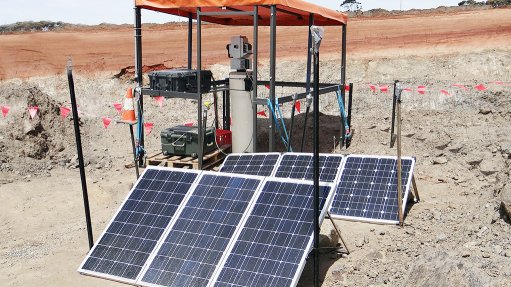
The mine will use the Sentry monitoring system, designed by mining software, hardware and services provider Maptek, to conduct geotech analysis.
Maptek marketing communications manager Jane Ball says the value for any mining operation that buys the laser-based system is the system’s flexibility.
She adds that the I-Site laser scanner can be used to conduct mobile and tripod surveys throughout a mining operation to estimate stockpile volumes, as well as conduct highwall mapping and geotechnical studies. It can also be used in a fixed position to monitor the rate of surface movements.
“Sentry has an easy-to-use interface that streamlines the scanning and reporting workflows. Users can select multiple zones of interest to watch and customise the scanning intervals and notification thresholds.”
Ball says the Sentry monitoring system was released to market in September last year, after it had been developed in Adelaide, South Australia, where I-Site laser scanners and other spatial software systems are designed and built.
She says feedback from surveyors and geotechnical engineers at customer mine sites helped Maptek to refine the system.
Ball tells Mining Weekly that the Sentry monitoring system can be used by any mining operator, including those in Africa, that wishes to adopt a flexible and versatile monitoring system.
“Mines can use the system for tracking surface movements over time, analyse the cause of any subsequent failures and maintain a rockfall database to prevent future incidents,” she says.
She adds that the system is sold globally through Maptek’s office network and that the company also offers training and support to customers on delivery or implementation of the system.
Well Suited
Havilah Resources MD Chris Giles says the Sentry monitoring system is ideal for the Portia mine.
“The Portia mine is unusual, as the gold deposit is about 60 m to 70 m below a surface of soft clay material. To my knowledge, no one has dug a mine through this material, at such a depth, before in Australia. Normally, miners cut through more stable surface material such as rock,” he says.
Given these circumstances, Giles says wall integrity accuracy is critical, especially for worker safety, adding that the accuracy of the Sentry monitoring system enables the mine to measure any movement in the mine walls to a couple of millimetres.
“If the data shows a wall is burgeoning, it can indicate possible future pit wall failure; the problem can be addressed safely and quickly. This system enables us to measure wall movement of just a half a centimetre, up to a kilometre away.”
The automated system constantly scans walls and zones, and sends the information to a surveyor or engineer using a laptop or tablet, says Giles.
“It also enables us to determine volumes accurately, measuring how much material has been added to stockpiles and aligned with material taken out of the mine, right down to a couple of cubic centimetres.”
Maptek I-Site hardware research and development manager James Howarth says the Sentry monitoring system eliminates the need for a surveyor or engineer having to physically enter an active mining area to collect data, and for deploying expensive radar measuring equipment unnecessarily.
“Sentry can also be used to alert staff when surface movements approach certain thresholds and is ideal for detecting small movements over a long period of time to identify trends.”
He concludes that remote detection causes no interruption to mining activity and can be controlled from the field or the office, while scans can be viewed in real time.