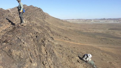
CONTEMPORARY GEOLOGICAL WORK Modern geological maps are produced by teams of multiskilled geologists and research specialists through a multidisciplinary process
Photo by: MSA Group
Geological mapping has represented the core function of the Council for Geoscience (CGS) for more than 100 years. Geological maps provide the base information for a range of applications, including mineral exploration and hydrogeological, engineering and environmental investigations, as well as natural science research.
CGS consultant geologist Paul Macey elaborates that modern geological maps are produced by teams of multiskilled geologists and research specialists through a multidisciplinary process that includes project management, literature surveys, remote sensing, fieldwork and logistics, research, map compilation, the writing of explanations and manuscripts and digital database management.
He says that modern geological mapping requires all the same observation and research skills of traditional mapping, but is aided by a number of technological innovations.
Macey says that the most significant of these is the availability of free to relatively cheap high spatial and spectral resolution, multispectral and hyperspectral satellite data, most notably the advanced spaceborne thermal emission and reflection radiometer; land and satellite imagery, Sentinel satellite imagery and the Google Earth imagery platform.
He remarks that, in addition to largely replacing distorted aerial photographs as base mapping material, the spectral bands of the multispectral and hyperspectral data can be manipulated through band ratios and band combinations and advanced statistical analyses, such as principal component and cluster analyses and rule-based supervised classifications, to highlight rock types, enhance structures and map hydrothermal alteration.
“These data not only improve the mapping but also speed up the process, which is a necessity in commercial projects, where field times are often an order of magnitude less than for traditional statutory projects,” Macey highlights.
He comments that the second major innovation is the shift to digital workflow. This starts with the capture of existing analogue raster (scanning, georeferencing and reprojection) and scientific point data into Explorer and ArcGIS databases, together with the available digital satellite imagery, geophysical and geological map raster and vector data sets.
Macey explains that these data are then analysed to compile preliminary map products and to design the scientific work plan. He says that, once in the field, the modern mapping geologist uses “ruggedised” tablet computers with customised data-entry software, such as the British Geological Survey’s Sigma mobile system, and geospatial capability to view the remote sensing and georeferenced geological map data and capture field data in real time.
Macey says that the field data are then used in conjunction with the remote sensing imagery to compile new maps. He points out that Google Earth is an important tool during compilation, as it allows the geologist to view the geology in high resolution and in three dimension, and that, with the much improved interoperability between ArcGIS and Google Earth, it can be used as a digitising tool as well.
“The new map and georeferenced research point data (structure, pressure-temperature conditions, geochronology and geochemistry) are then included in the digital project database, which improves our ability to analyse the data and makes the data more secure and accessible.”
Further, Macey notes that, by virtue of built-in databases or attribute tables, geological maps compiled from these digital data sets are themselves fully digital and can be interrogated by various attributes or by location, or by both.
He says that the third change to mapping has been the need to manage field risk. Macey points out that, with the advent of commercial mapping outside South African borders, CGS geologists have had to develop new working procedures, including risk analysis and risk mitigation processes, to counter limited infrastructure, medical risks (malaria, landmines and security), language barriers in non-English-speaking countries, poor access to outcrop and the health and safety demands of international clients.
“[As] each country has its own challenges, the mapping teams have had to have flexible logistical plans and use other forms of transport (donkeys, motorbikes, canoes, quad bikes and helicopters) and communication (satellite phone, email, CB radios and mobile phones),” he concludes.