FIELD WORK New mineral deposit discoveries will stimulate exploration and mining investment in South Africa
Although South Africa has considerable mineral resources, its long history of mining has resulted in the complete or partial depletion of reserves and resources, says Council for Geoscience (CGS) chief research scientist Dr Alazar Billay.
Additionally, he notes that the increasing depths of mining operations have resulted in rising costs, which have made many mines marginal or altogether unprofitable.
However, to reverse the decline in mining and mining-related investment in South Africa, government has provided the CGS with “considerable” funding to acquire high-quality geoscience data that may result in the discovery of new mineral deposits.
Billay highlights that such discoveries would stimulate exploration and mining investment in South Africa. He emphasises that precompetitive high-quality geoscientific data and products are key to reducing exploration risk and to attracting mining exploration investment.
The CGS is currently in the second year of a three-year research project, which is focused on three of South Africa’s historically less systematically explored, but highly prospective, regions, namely the area between Prieska and Springbok, in the Northern Cape; the Tugela area, in northern KwaZulu-Natal; and the Barberton and Sabie-Pilgrim’s Rest areas, in Mpumalanga.
Billay explains that the selection of the project areas was based on several factors, including mineral occurrences, comprehensiveness of previous exploration endeavours, and the degree of exposure of the geological units and their current exploration and mining statuses.
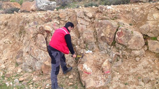
He states that the methods of data acquisition include (or will include) high- resolution airborne magnetic and radiometric surveys, regional sampling, high-resolution airborne electromagnetic (EM) surveys for selected areas and high-resolution airborne gravity survey on restricted areas.
The application of remote sensing, geological mapping in selected target areas, aggregate-quality mapping, imaging mineral belts and districts using conventional seismic and ambient noise methods and magnetotelluric surveys will also be employed.
Additionally, Billay notes the CGS will use follow-up ground geophysical and biochemical work on identified mineral potential targets and undertake limited drilling on targets identified during the follow-up surveys to uncover the required geoscientific data.
He says that the data processing includes the processing of the various geoscience datasets and multiple types of geoscience maps. Regular input by and between geologists, geophysicists and remote sensing specialists will also form an integral part of the processes.
Billay remarks that the integration of the acquired and processed data using various techniques and the production of mineral prospectivity maps will also be undertaken by the CGS.
“The aim of the project is to produce various geoscience maps and reports and mineral prospectivity maps accompanied by supporting reports. The data will form part of the geoscience database to be reprocessed and/or used by researchers for a variety of purposes, including, but not limited to, mineral, water and environmental studies,” he emphasises.
Billay highlights that not all the possible mineral exploration techniques have been applied by the CGS to date, in particular, the gravity, EM, magnetotelluric and seismic methods, as these will be applied selectively owing to the high cost associated with their use.
He points out that airborne aeromagnetic radiometric surveys, together with regional soil sampling, form the core activities of data acquisition for the CGS projects. Mapping remote sensing data applications is also restricted to selected areas within the mineral belts.
Moreover, Billay says that, although the focus of the research is currently on outlining mineral targets, statutory activities such as the South African Mineral Deposits Database should be included as part of the research.
“New databases including lithogeochemical, geochemical and metamorphic information should be introduced at the CGS. These databases are crucial to successful mineral prospectivity modelling,” he concludes.
Billay was a presenter at the CGS 2016 conference, in Tshwane, last month.