HIDDEN GEMS? In its efforts to boost mineral exploration and mining revenue, the Angolan government has launched a mapping project to discover untapped mineral reserves
Malawi has signed an agreement with a consortium of geological survey organisations for a countrywide Geological Mapping and Mineral Assessment Project (GEMMAP) to assist in the growth of the minerals sector by providing detailed references for mineral exploration and mine planning.
The consortium – comprising French geological survey the Bureau de Recherches Geologiques et Minieres (BRGM), Finnish geological survey the Geologian Tutkimuskeskus and South Africa’s Council for Geoscience (CGS) – won a tender to conduct the mapping programme, which was launched in June. The agreement was signed on behalf of the consortium by BRGM chairperson Vincent Laflèche and Ministry for Natural Resources, Energy and Mining permanent secretary Kester Kaphaizi.
The €10.2-million GEMMAP, funded by France under a debt agreement with the Malawi government, is meant to support economic development in Malawi through growth and diversification of its mineral resources sector by updating geological map coverage and providing an inventory of the country’s mineral potential at a sufficiently detailed scale (1:100 000).
The GEMMAP will run for about five years. In addition to the production of several geological maps covering the entire country, the programme will result in a geological survey of river and stream sediments and natural hazard mapping, assess the country’s mineral potential and small-scale mining sector, and develop a database and geographic information system.
Most of these activities include a comprehensive compilation phase to integrate archival data from engineering studies, field surveys and laboratory analyses into the current project. Subsequent fieldwork and laboratory analyses will involve a large number of specialists in various disciplines from the BRGM and its partners.
An important component of the GEMMAP, highlighted by the CGS, is the training programme based on field studies, which is supervised by the consortium’s geoscientists. This will include short-term training abroad on specific topics at the offices of consortium members and other specialised centres, as well as diploma courses for master’s and PhD candidates.
The training will benefit geologists working for Malawi’s Geological Survey Department and Department of Mines, says the CGS. Both departments will be actively involved in the project implementation.
The GEMMAP is complementary to and coordinated with the activities and results of an ongoing sister project, the Mining Governance and Growth Support Project (MGGSP), which is financed by the World Bank and the European Union.
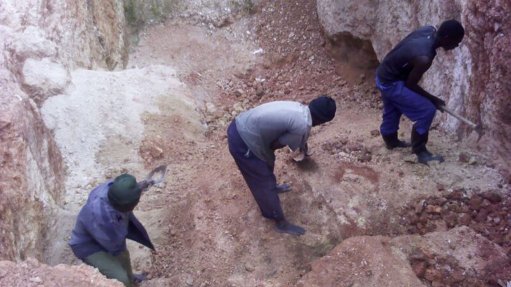
The MGGSP started in 2011 and is meant to address challenges within the Malawi minerals sector, which has been characterised as neglected and underperforming by the Malawi government, the US Geological Survey and the World Bank. The sector predominantly comprises artisanal and small-scale operations, and produces mainly aggregates, lime, gemstones, coal and uranium.
After the 2009 global recession, the Malawi Economic Growth Recovery Plan and the Malawi Growth and Development Strategy both identified mining as one of the priority sectors to spur growth and improvement in the lives of Malawians. Therefore, the country’s government has since adopted new mining policies and introduced initiatives such as the MGGSP to bolster the mining sector.
Aside from the GEMMAP, the MGGSP has also allowed stakeholders to discuss the feasibility of revising the geoscience curriculum at Malawi’s tertiary institutions, notes the Department of Earth Sciences (DES). The country’s National Consultative Stakeholder’s Curriculum Review conference took place in August, and was organised by DES, and funded by the MGGSP.