Photo by: Bloomberg
PERTH (miningweekly.com) – The Queensland government on Monday launched public consultation on a proposed boundary for a master planned area for the Port of Gladstone, to help better manage impacts of port operations and port development on adjacent land and marine areas.
State Development Minister Anthony Lynham said that the initiative would drive economic development in, and around, Gladstone’s port and protect the Great Barrier Reef.
“The master plan will set a clear direction for the future for Queensland’s second busiest port and help protect the reef,” Lynham said.
“It will help make Gladstone’s port precinct a more attractive development option, giving potential investors greater certainty about infrastructure essentials like transport and utilities corridors.”
The Minister last week introduced the new Sustainable Ports Development Bill, aimed at protecting the Great Barrier Reef World Heritage Area. The Bill would prevent disposal of capital dredge spoil from ports in the Great Barrier Reef area, stop the development of new ports in the Great Barrier Reef area, and would mandate master plans for all four priority ports, supporting further local development and investment.
Master planning at the priority ports of Gladstone, Abbot Point near Bowen, Hay Point/Mackay, and Townsville also formed part of the Queensland government’s commitment to the Reef 2050 Long-Term Sustainability plan.
Lynham, who is also the Natural Resources and Mines Minister, noted the Queensland economy relied on ports, particularly the major bulk commodity exporting ports adjacent to the Great Barrier Reef World Heritage Area.
“Port master planning considers marine and land-based impacts, port and supply chain capacity and connectivity, and environmental and community values. Port master planning for the four Queensland priority ports, including Gladstone, will help better manage impacts of port operations and port development on adjacent land and marine areas,” he said.
The Minister said that through master planning, the state government would better manage areas needed for the effective operations and development of the port, including road, rail, electricity and gas pipeline corridors now and for the long term, while protecting community and environmentally-sensitive areas.
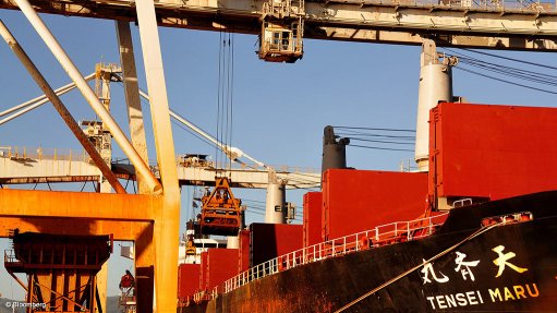
Gladstone had a throughput of more than 97-million tonnes in 2013/14, making it Queensland’s second-busiest port after coal export port, Hay Point near Mackay. Cargo loaded at Gladstone included coal, mineral and petroleum products.
The proposed Gladstone master-planned area encompasses a total area of about 88 000 ha and includes 4 321 ha of land controlled by the Port of Gladstone, 29 000 ha of the Gladstone State Development Area, and marine components within the port limits.
Lynham said the marine components would not include the Port of Rockhampton (Port Alma), the Fitzroy Delta, Keppel Bay or North Curtis Island.
“It’s part of our commitment to protecting the reef to exclude these areas from priority port development,” he said.
Public comments on the proposed boundary were open until July 20, and would be incorporated into a draft port master plan that would be issued for public comment later this year.