INTERNET OF FARMING Farm21's sensors and application provides farmers with satellite imaging and in-depth information
Agricultural technology developer Farm21 aims to assist 10 000 farmers globally in making better farming decisions by 2024 using its pinpoint accuracy solution, says Farm21 partnership manager Dewald de Vos.
He says farmers want to keep their businesses resilient amid the increasingly challenging conditions regarding the changing environment and production goals in the agriculture sector.
The company’s solution can also assist farming consultants and researchers by providing them with information to assist with research, product trials and testing in an affordable way.
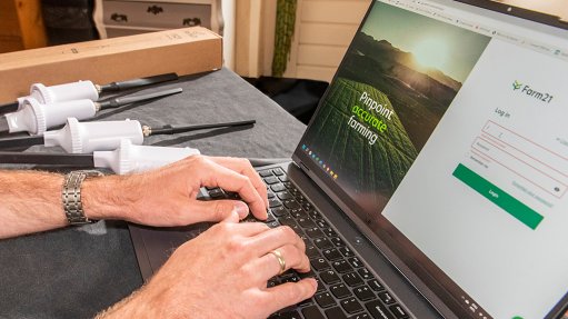
The Farm21 solution comprises the Farm21 application (app), along with the company’s remote infield FS21 sensors. The app uses satellite imaging and information, while farmers can gain access to weather, soil and crop data using the app, as well as use its field-scouting journal.
The solution aims to provide hardware and a user-centred approach, with a flexible dashboard and insights on the app.
It also aims to provide ten times the data points than were traditionally available from conventional information sources and data collection methods. The FS21 sensors are currently the most cost-effective soil sensors available on the market; therefore, users can deploy more sensors – and receive more information – to provide more accurate and complete insights of fields.
“Historically, it’s been expensive to gather this sort of information. At Farm21, we want to change that,” adds De Vos.
Further, SIM cards enable the sensors to have global connectivity. Traditionally, sensors had to have a direct line of sight to provide information, but Farm21’s approach to analysis is similar to that of cellphone connectivity – if there is cellphone reception, the probes will work.
As a result, consultants for smaller, remote farming communities can provide advice for many farmers across a large region or even a variety of regions, from a central point.
The Farm21 solution aims to assist farmers with resource allocation to mitigate the impact of challenges such as climate change, stricter environmental requirements and a growing population, along with increasing input costs.
Farmers face the challenge of having to protect their plants while achieving higher yields. To assist farmers in achieving this, the solution offers an array of data inputs that can pinpoint where to apply the necessary plant protection agents or fertilisers.
De Vos adds that climate change has a significant impact on farms. Farm21’s solution can identify which crops grow best in which regions, essentially creating a map in assuming where temperatures will increase in a specific region at a fixed percentage in the next few years.
Therefore, it will be able to recommend the crop types that can be grown in these areas.
Package Plans
Soil sensors have been expensive, owing to the cost of the instruments, as well as the maintenance and additional infrastructure required. As a result, small-scale farmers are not able to afford and use the technology, says De Vos.
However, Farm21’s cost-effective approach to its technology has enabled such farmers to adopt a technological approach to farming and reap its benefits.
The company offers users four package plans, with a variety of tools to cater to user requirements, and one plan offered free of charge; users can also create their own plan, in addition to the four plans.
“We provide the affordable census and the free platform for clients – be it the farmer or consultant assisting the smaller-scale farmers – to actually digest the data,” explains De Vos.
For large-scale producers, they can have more sensors in a field to gather information in a grid-like fashion, he adds.
Further, soil differences prevent farmers from using a standardised irrigation programme, since different soil types drain the water differently.
However, multiple sensors, located in various sections of a field, allow for data collection and soil assessments, which, in turn, can be used to detect the soil type. A standardised reading from the field can then be made.